Canoe Kayak Nova Scotia: Musquodoboit & Pennant River Paddling Maps
This project involved designing two high-contrast paddling maps for print, tailored for self-use by recreational paddlers. Working with Canoe Kayak Nova Scotia, I created updated maps for the Musquodoboit River and a new map for the Pennant River, ensuring both followed a consistent cartographic style and layout.
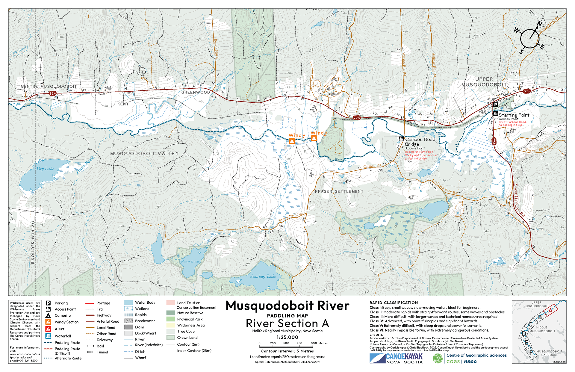
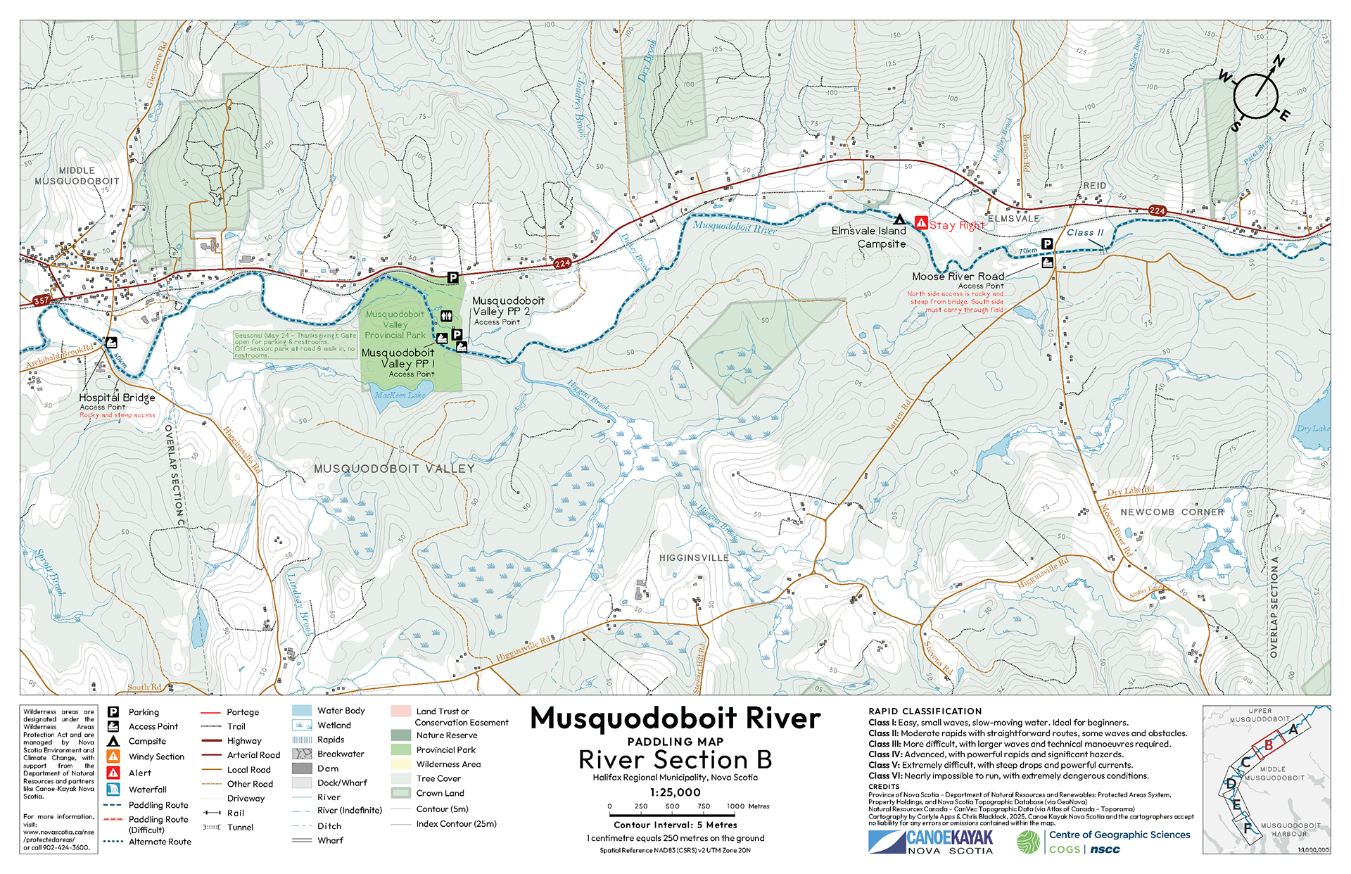
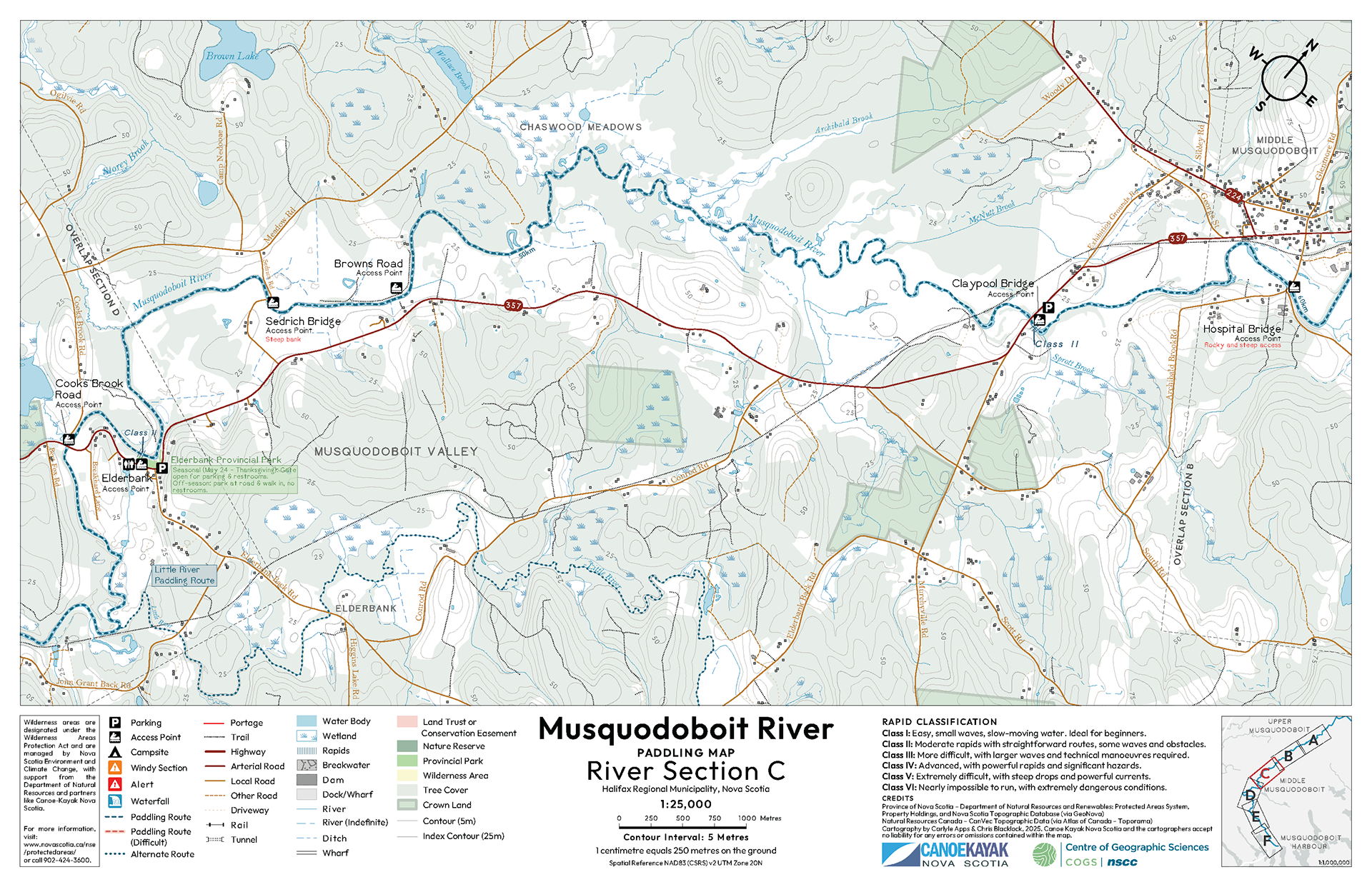
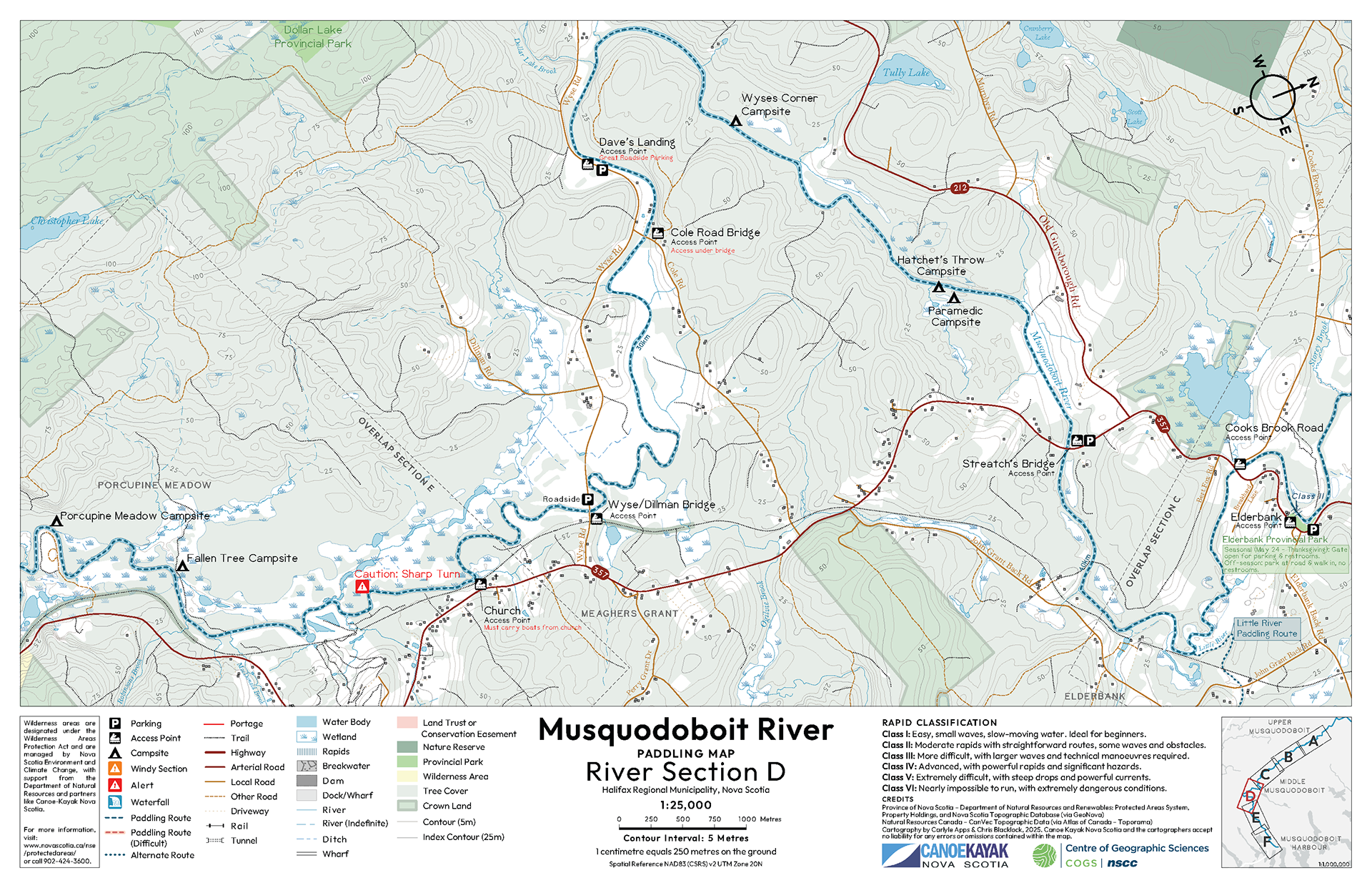
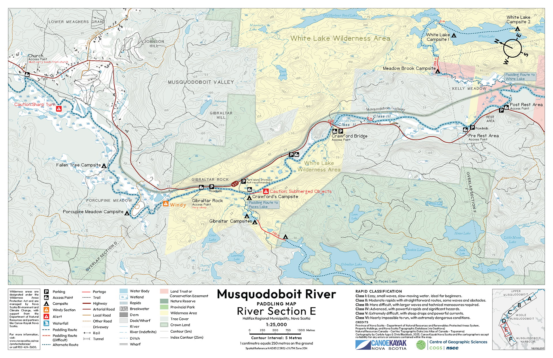
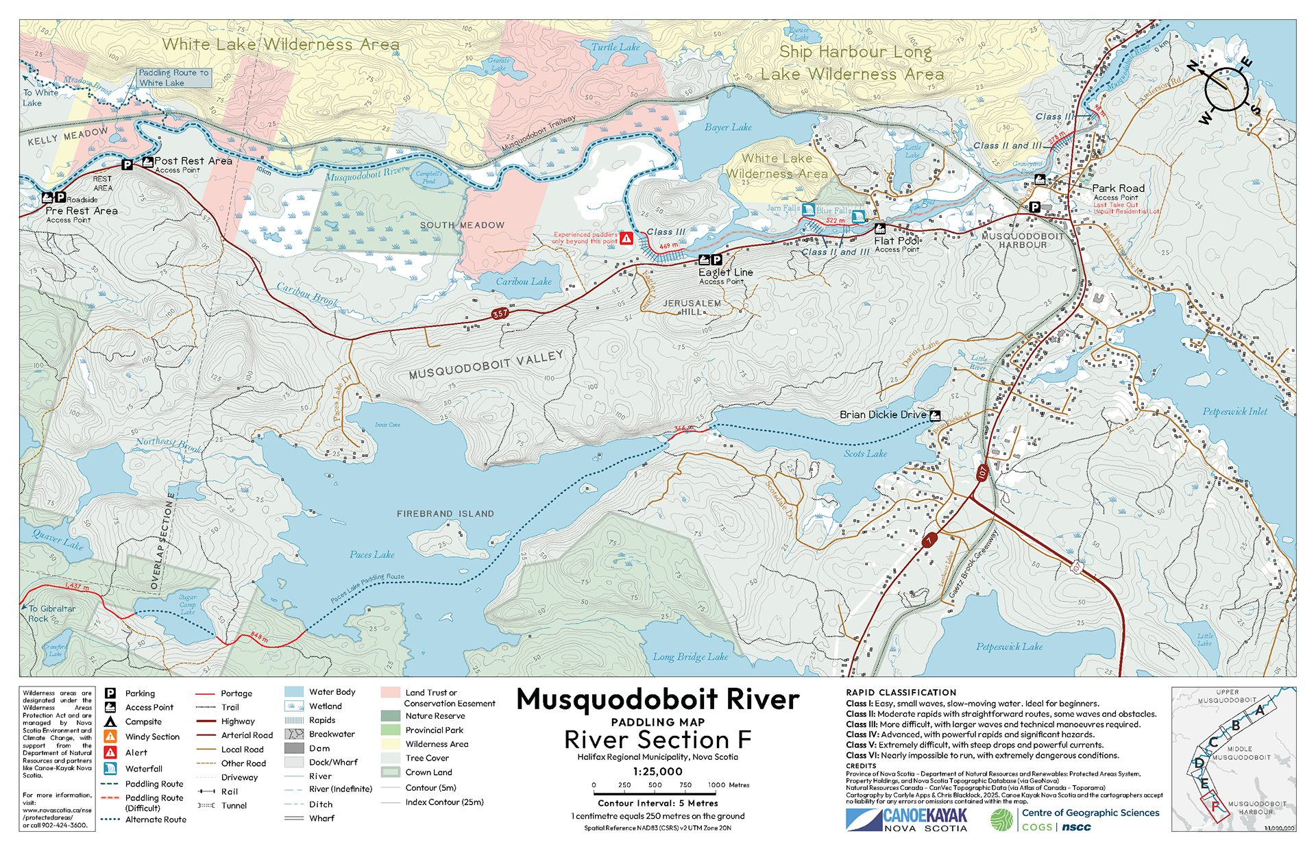
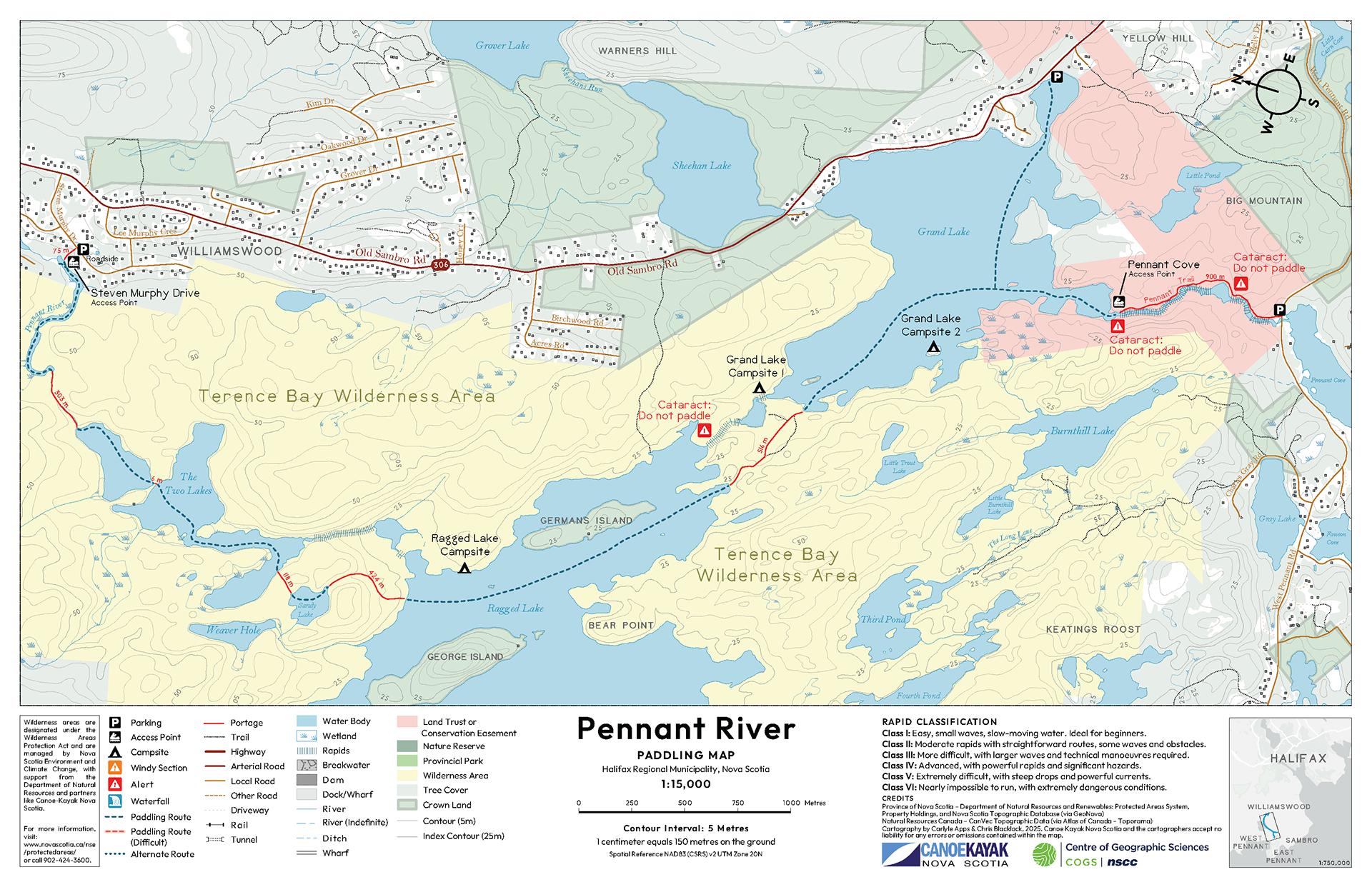
The Musquodoboit River, spanning over 80 km, required six separate map sheets. I rebuilt this map from the ground up using historical information and newly created spatial data, as no original digital files existed from the outdated 1998 version. The Pennant River map was designed entirely from scratch using primary and secondary data sources.
Both maps were designed for tabloid-size print with high visual clarity, prioritizing readability and usability on the water.
Software / Tools: ArcGIS Pro, Adobe Illustrator