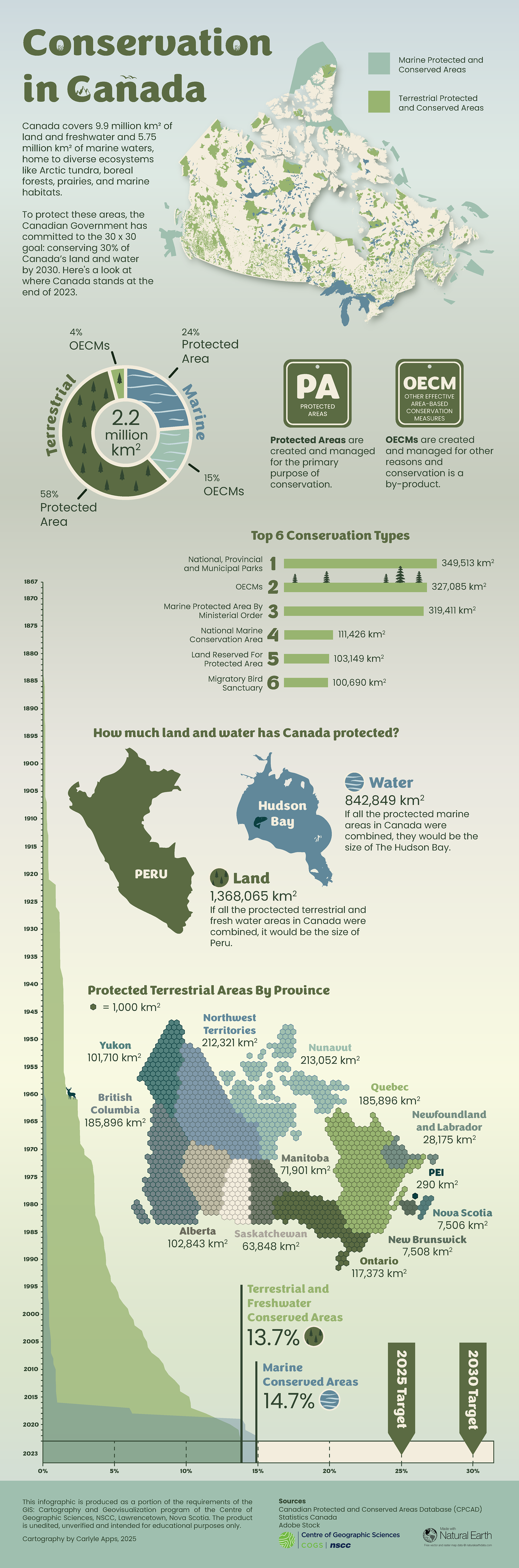
The purpose of this infographic is to communicate the status of protected areas in Canada and our progress toward the 30x30 conservation goal, an initiative the federal government has committed to, aiming to protect 30% of Canada’s land and waters by 2030. It’s designed for a Canadian audience of teens and adults interested in nature and environmental issues.
The colour palette was inspired by Canada’s diverse biomes (tundra, forest, prairie, boreal, and arctic) focusing on natural tones with greens and blues to distinguish terrestrial and marine areas. I used data from the Canadian Protected and Conserved Areas Database and Statistics Canada, and combined ArcGIS Pro, Excel, and Adobe Illustrator throughout the process.
Software / Tools: ArcGIS Pro, Microsoft Excel and Adobe Illustrator