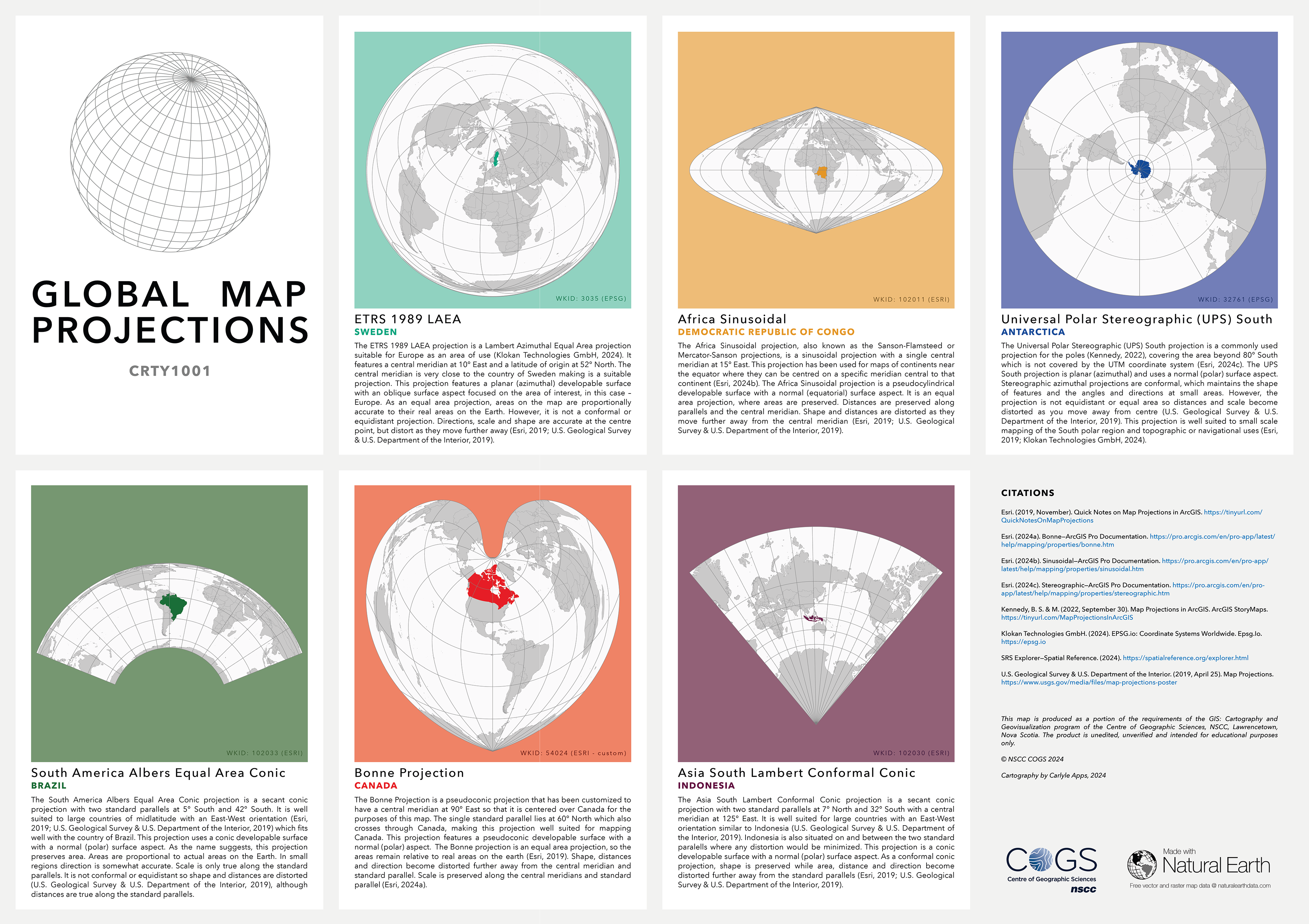
This poster project involved selecting and justifying appropriate projected coordinate systems for six countries across different hemispheres and latitudes. After researching common projections and testing options for each, I identified the most suitable system based on factors like developable surface, aspect, and distortion. The final design features a visually cohesive card-style layout, with color themes for each country and subtle backgrounds to highlight the projections. I included WKIDs for quick reference and aimed for a balance between clarity, accuracy, and visual appeal.
Software / Tools: ArcGIS Pro