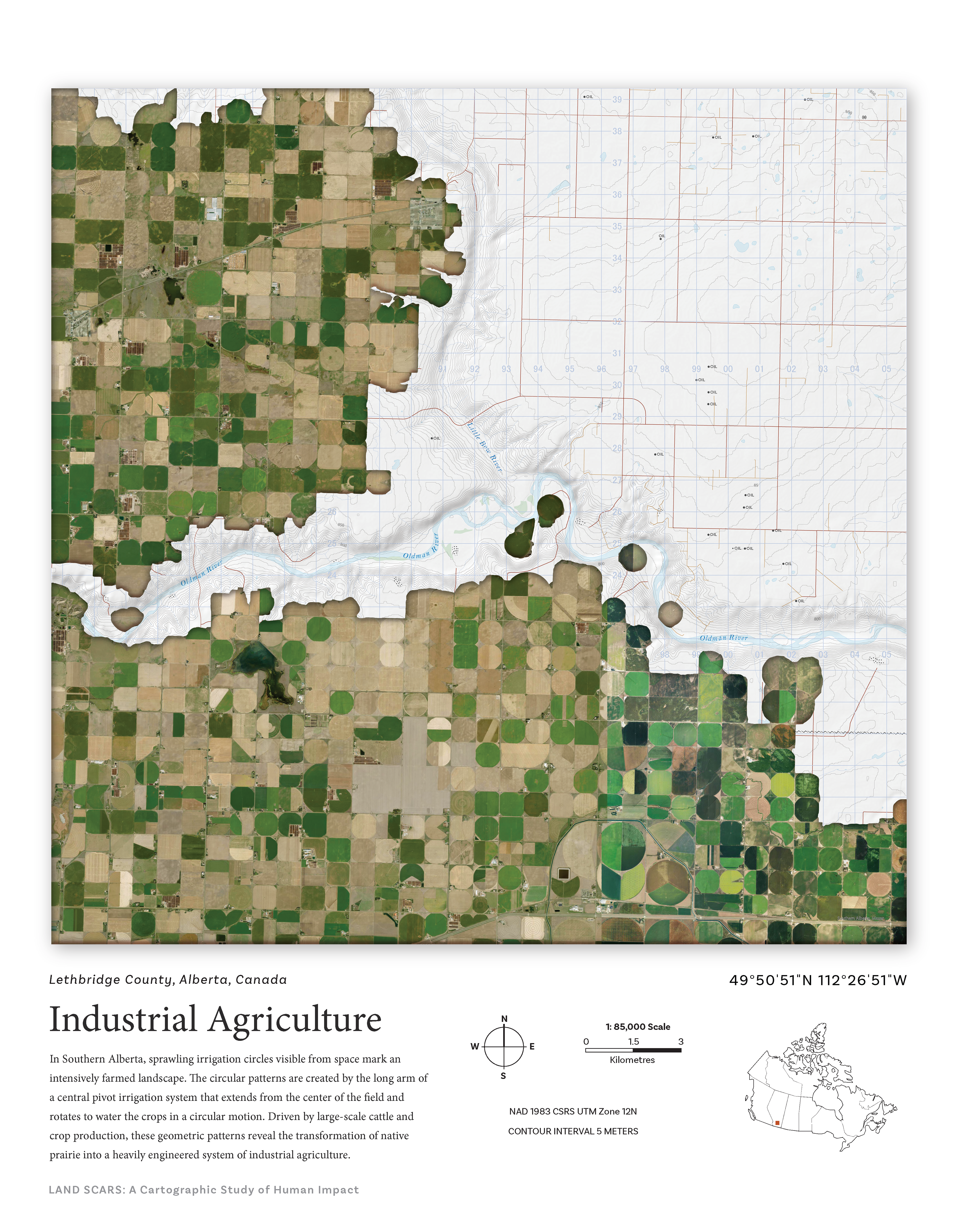
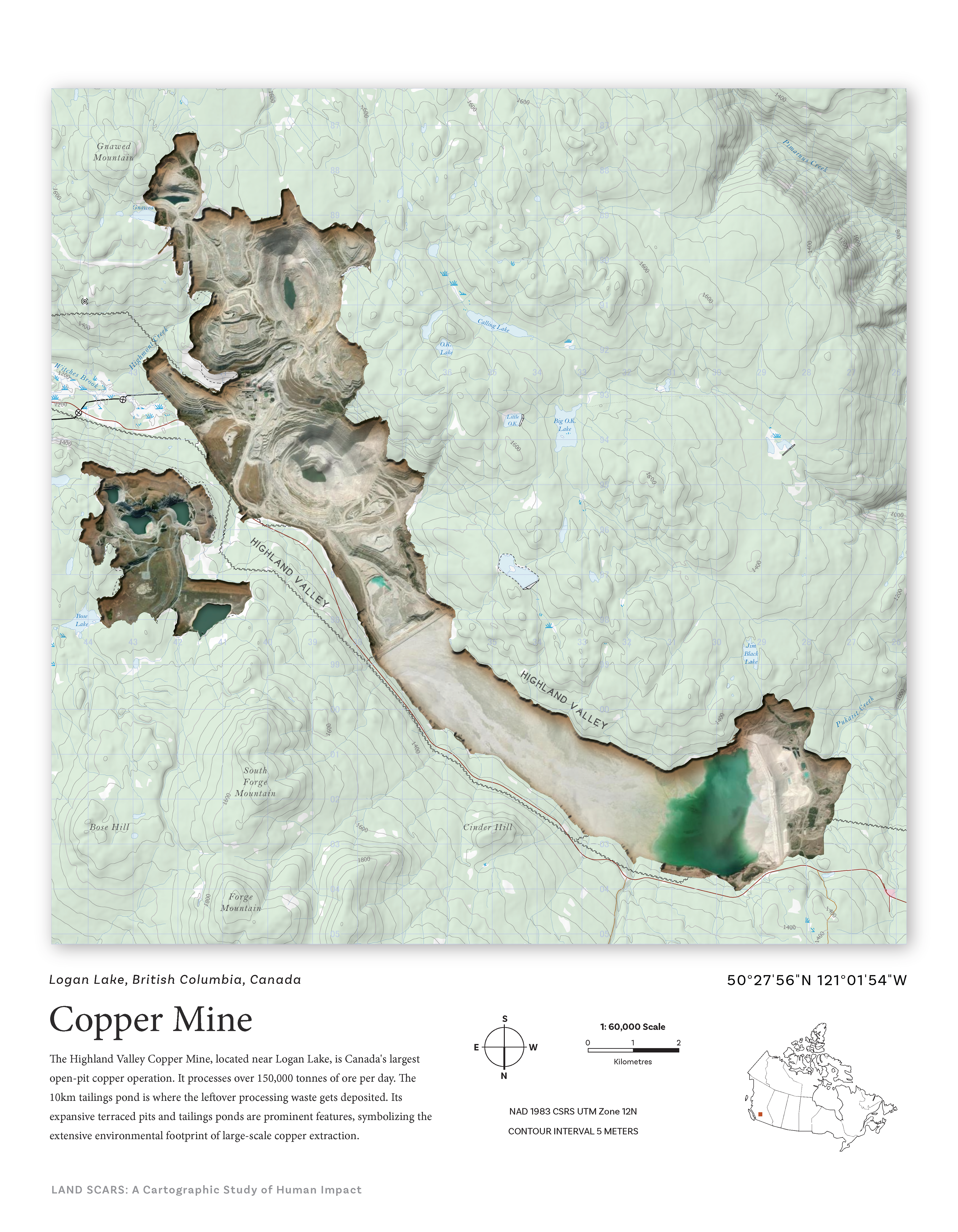
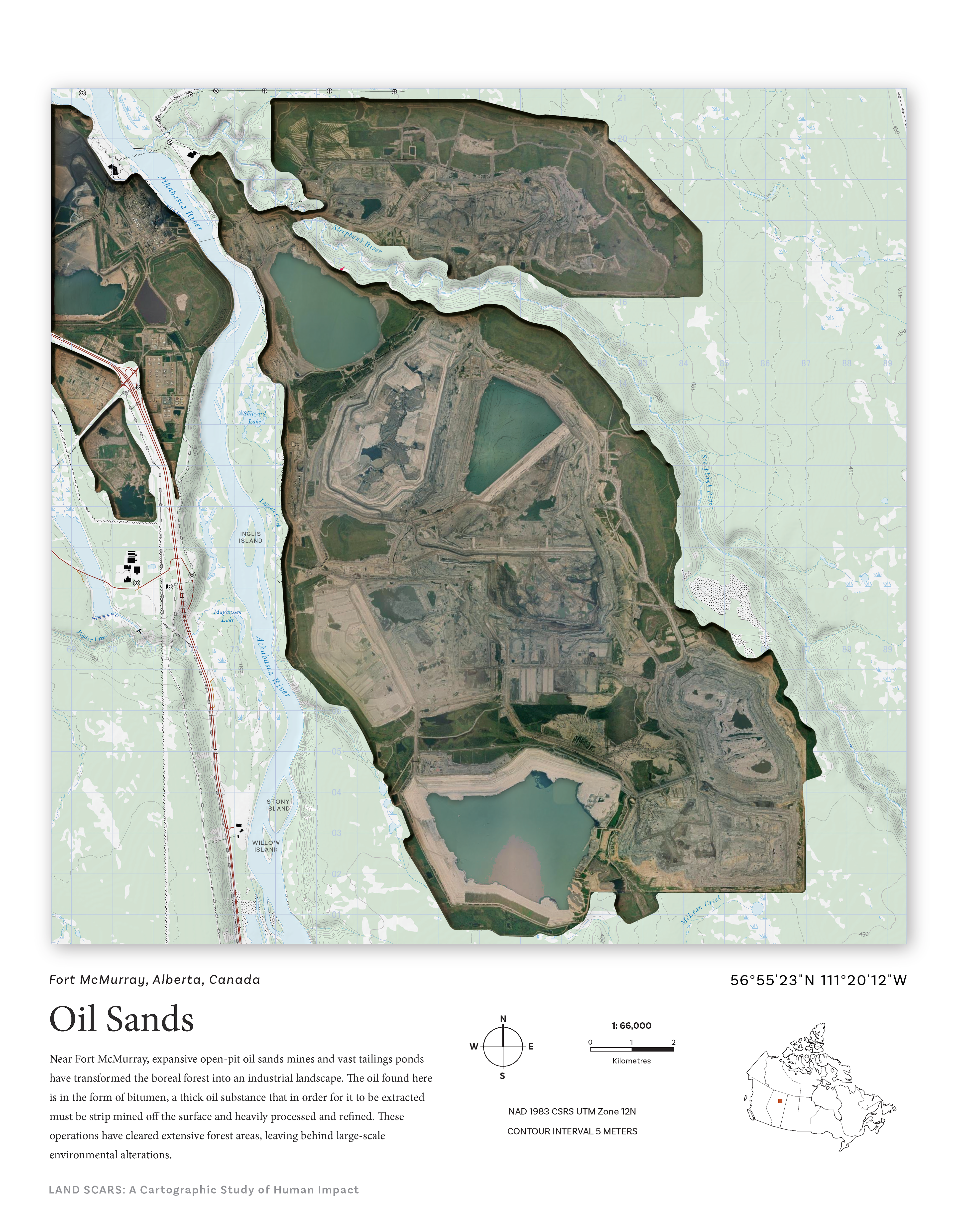
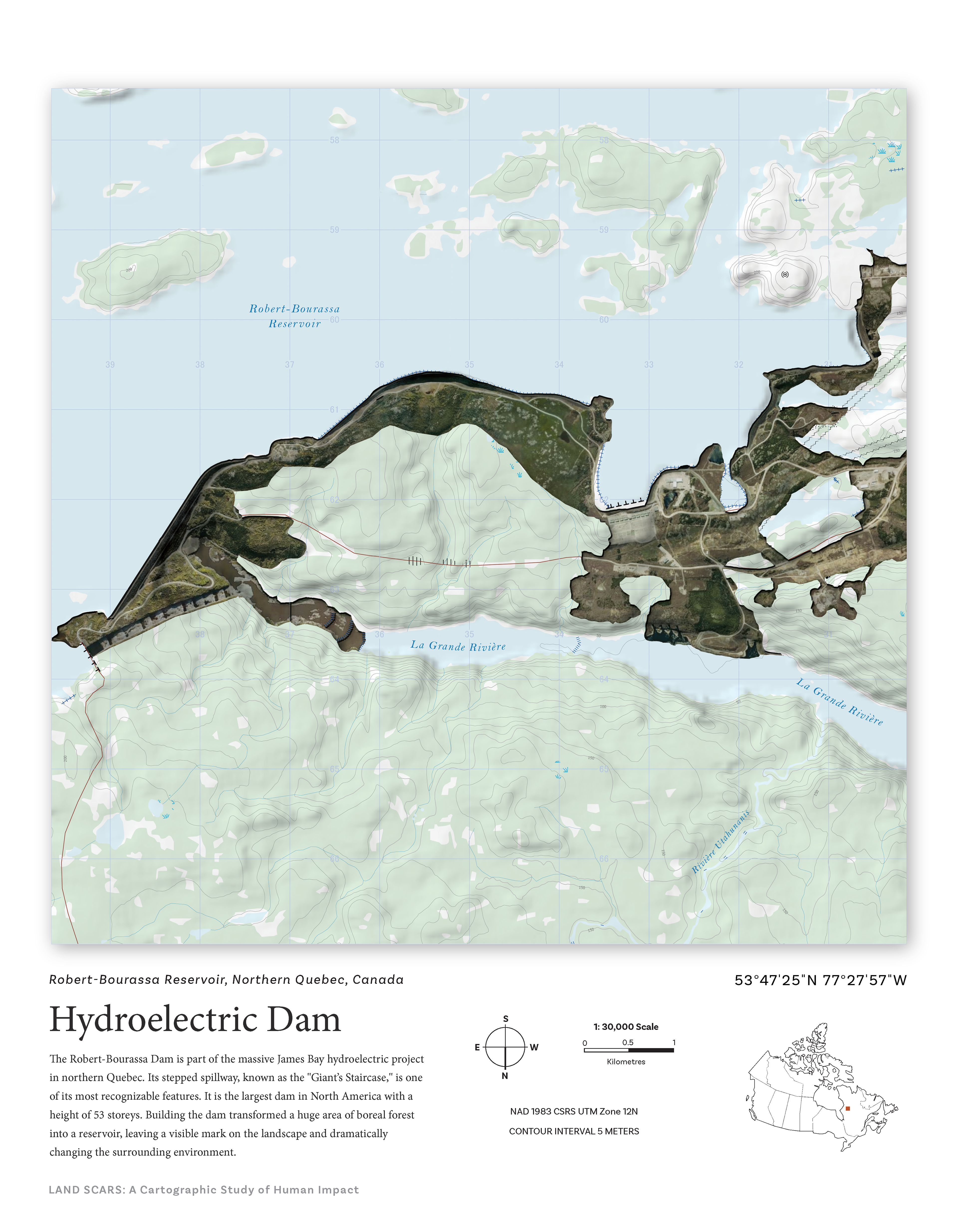
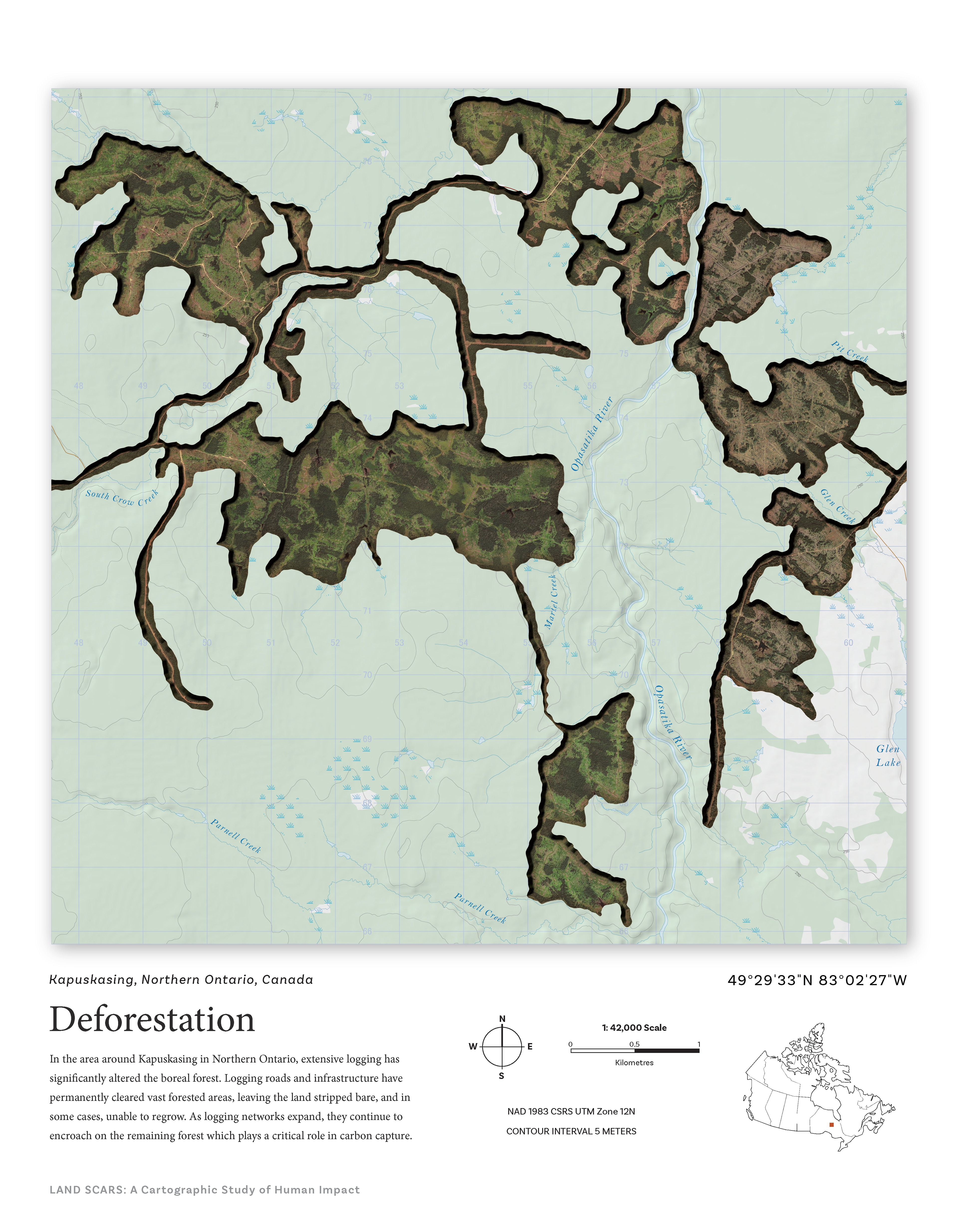
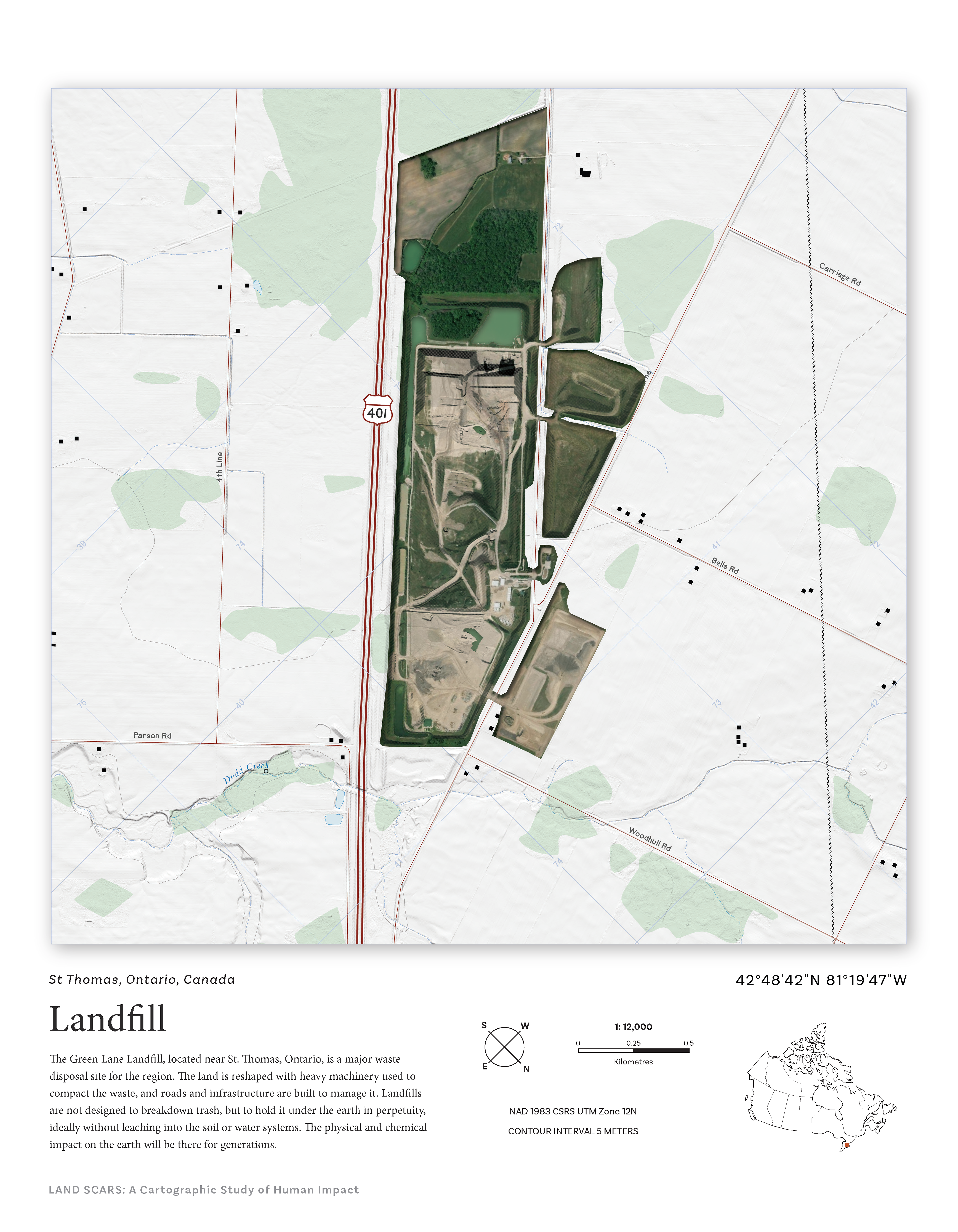
This was a two month independent project where I developed the concept, proposal, and design for a map series called Land Scars, which was six maps focusing on areas significantly altered by human impact, including a copper mine, the oil sands, industrial agriculture, deforestation, a landfill site in the GTA, and a hydroelectric dam in Quebec. Each map juxtaposes topographic styling with enhanced satellite imagery to highlight the scale and permanence of these "scars" on the land. The series was designed for print and accompanied by a cartographer’s statement.
Software / Tools: ArcGIS Pro, Adobe Photoshop, Adobe Illustrator