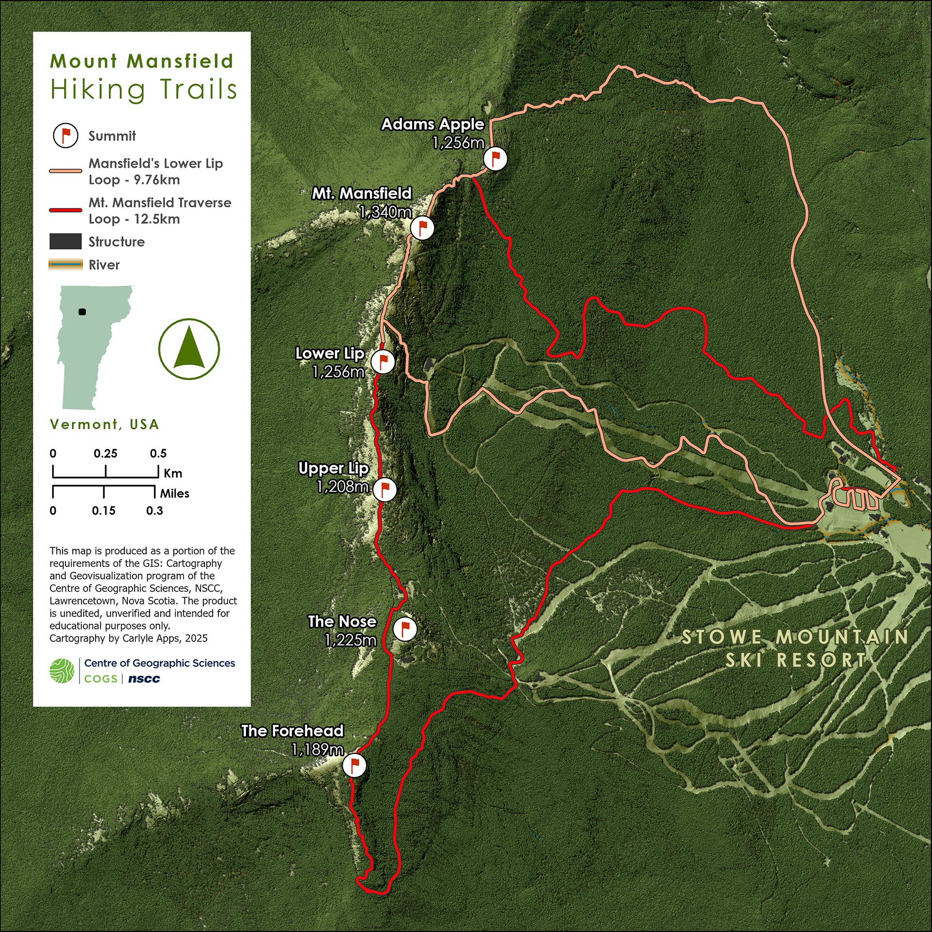
This map of Mount Mansfield in Vermont uses high-resolution LiDAR data to create a detailed large-scale realistic 3D map while incorporating vector data and map components to create a final map with a clear purpose and use.
Software / Tools: ArcGIS Pro, Adobe Photoshop