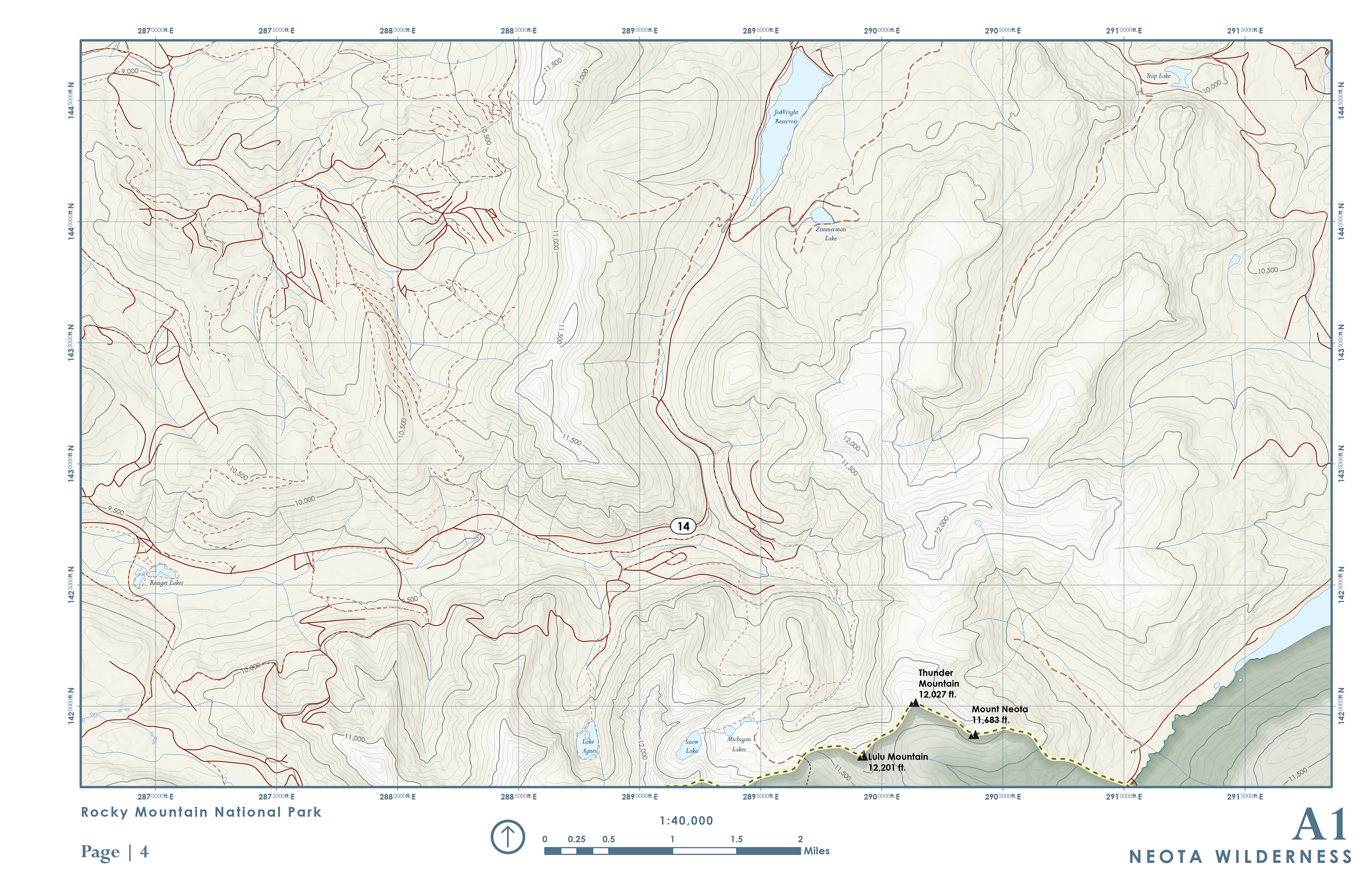
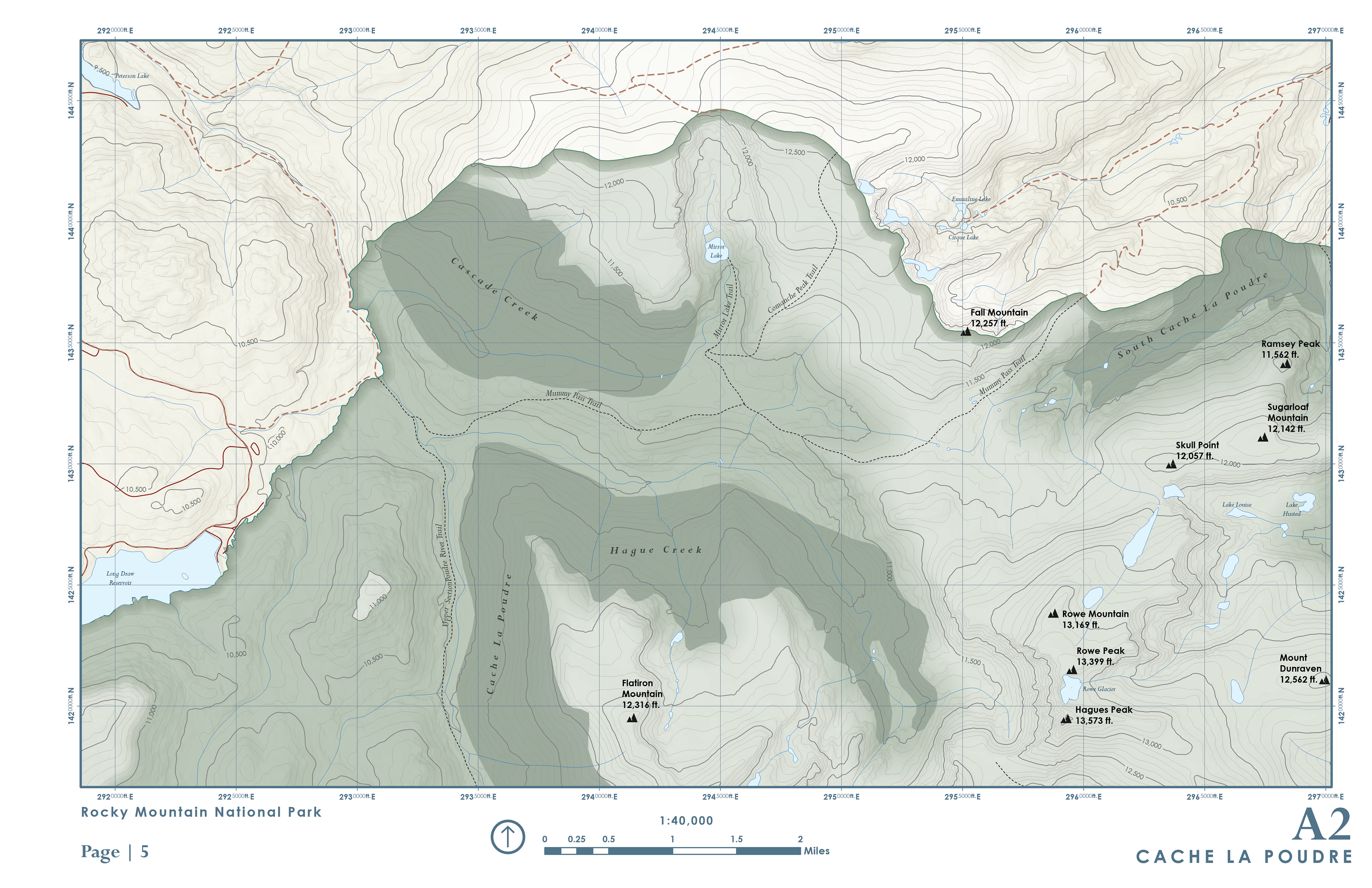
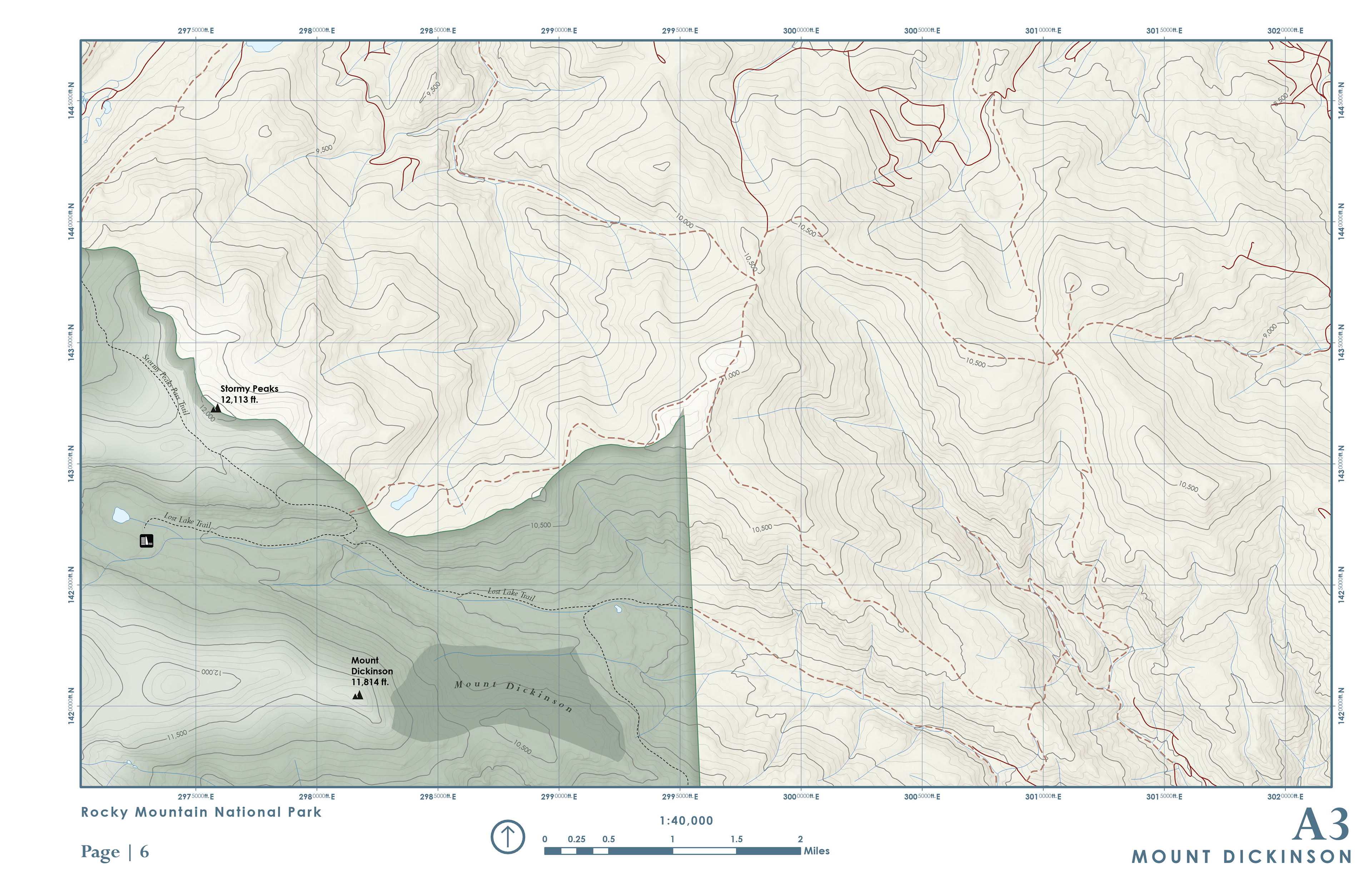
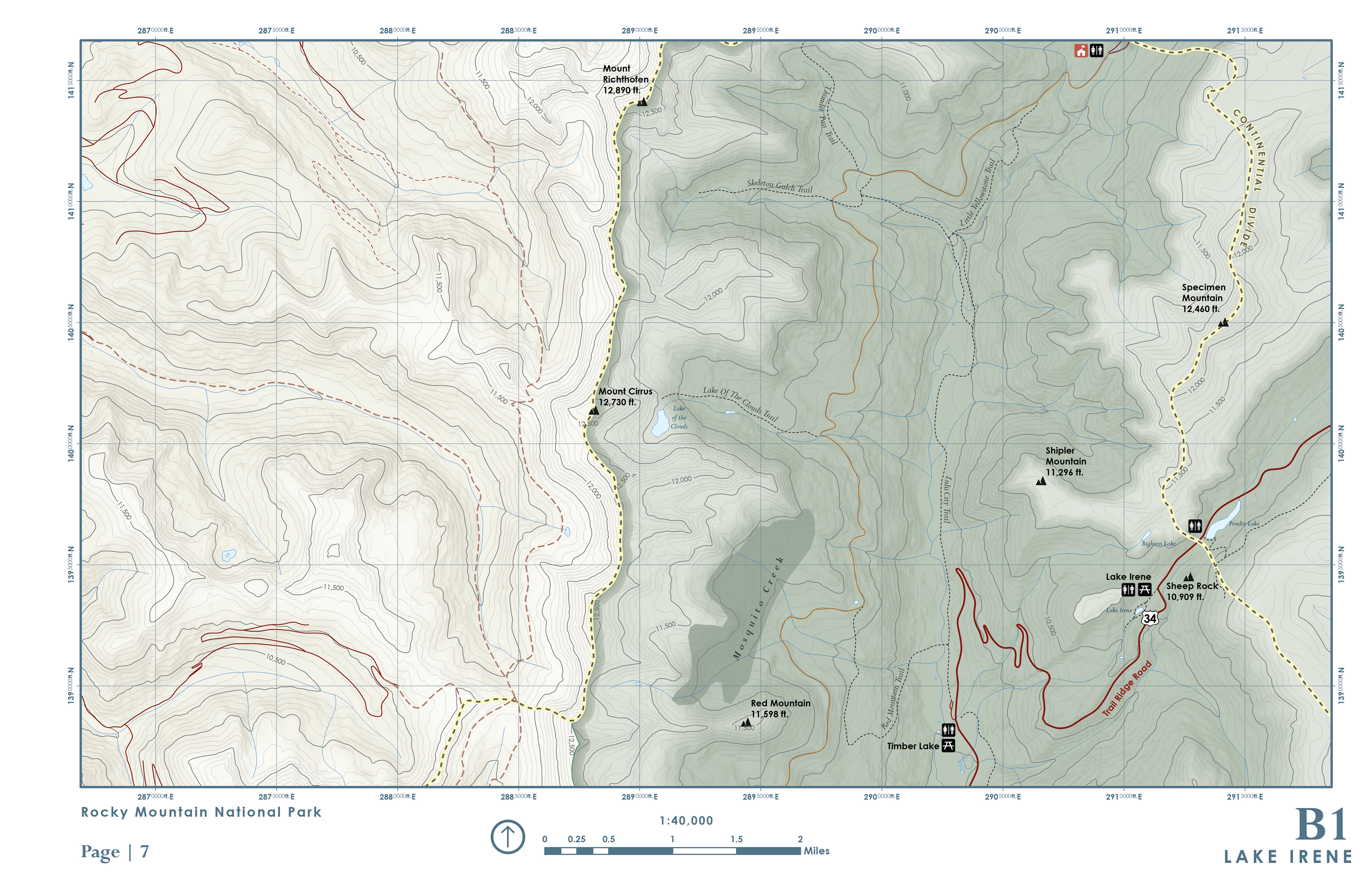
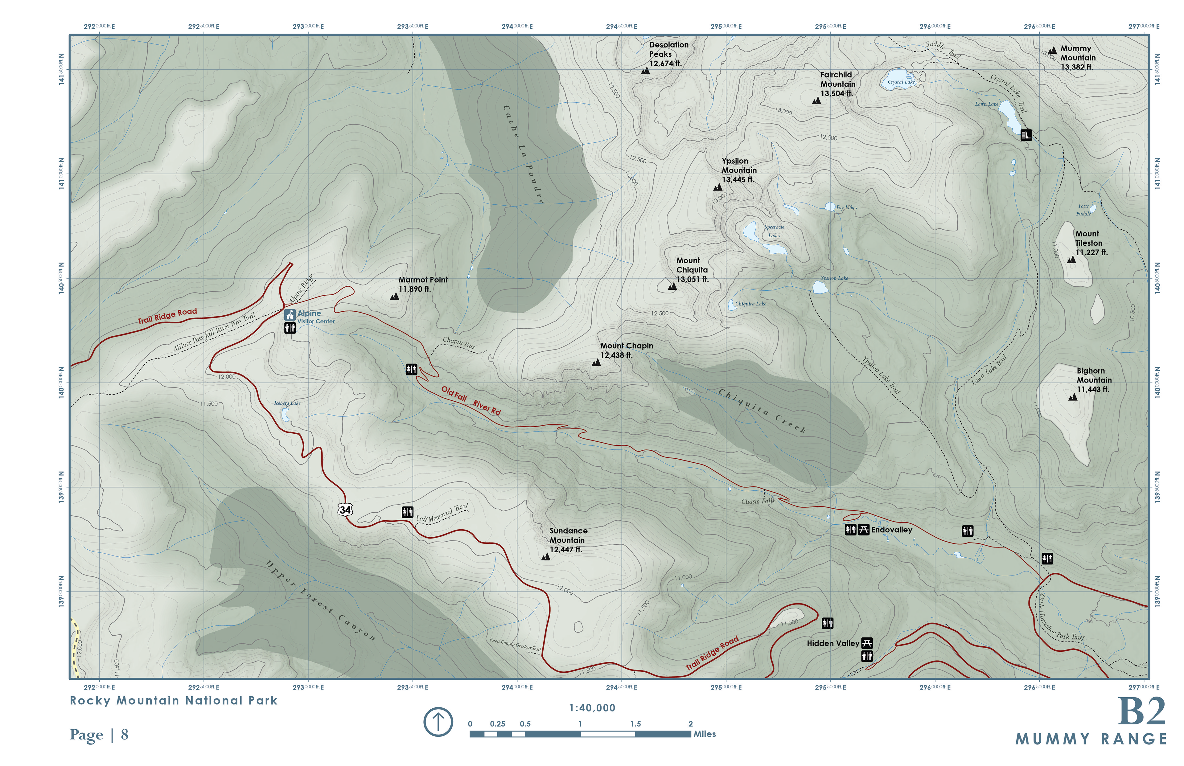
This 20-page atlas was created over two months and involved planning, organizing, and producing every stage of the project from start to finish. I built a structured GIS project, prepared and generalized the data for print, and used a mix of automated tools and manual editing to fine-tune the details. The map symbology draws from U.S. National Park Service and Natural Resources Canada styles, with some creative elements added. I converted labels to annotation for better control and designed a consistent layout with all the core map elements. The final atlas includes custom cover art and an introduction section, pulling everything together into a cohesive, print-ready piece.
Software / Tools: Entirely made using ArcGIS Pro with the exception of the cover art in Adobe Illustrator