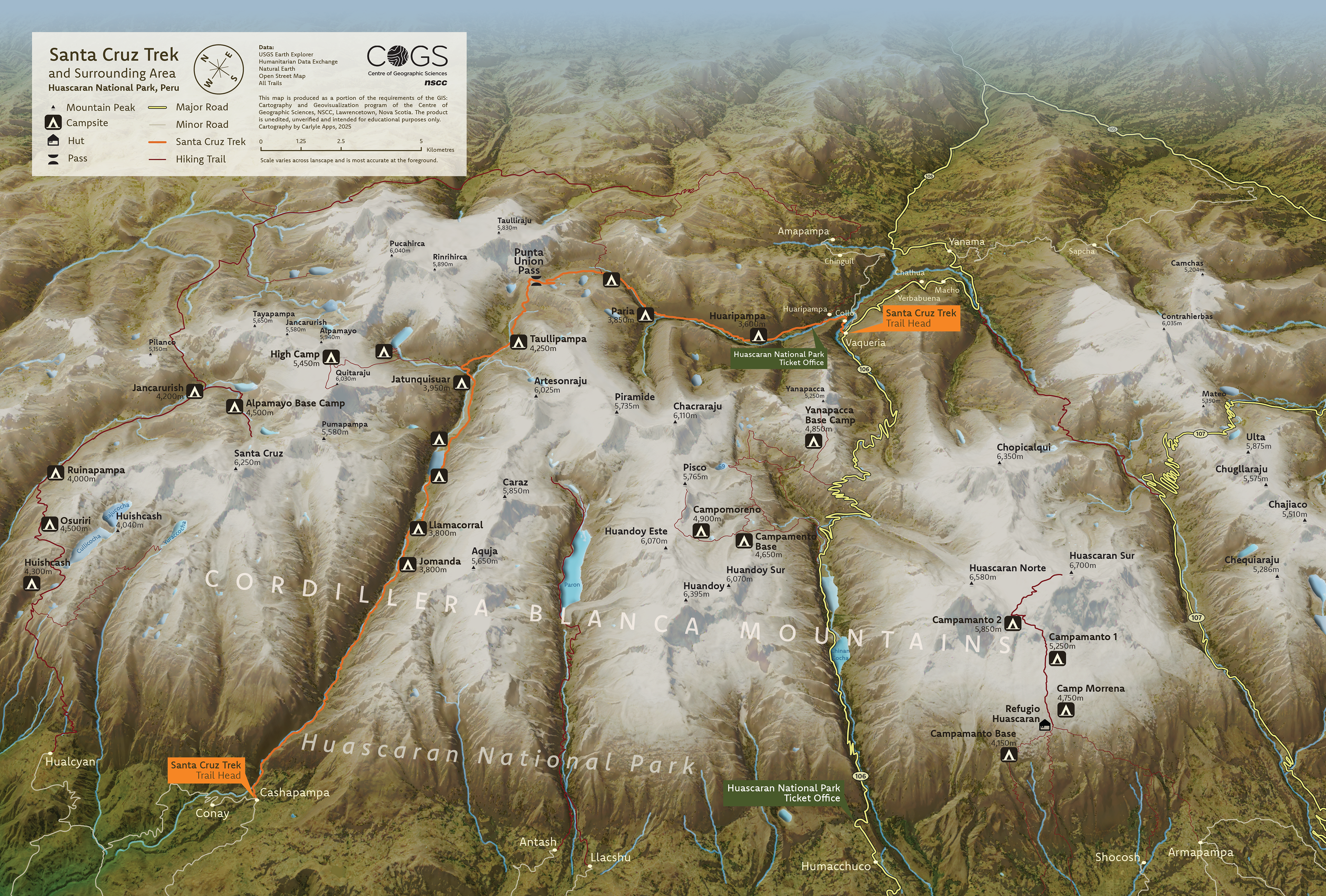
This project involved designing a 3D oblique panorama map of the Santa Cruz trek in Northern Peru. Using Landsat imagery to create a photorealistic basemap with relevant vector data applied.
Software / Tools: ArcGIS Pro, Adobe Photoshop, Adobe Illustrator